National Park Gaspesie or Parc National de la Gaspesie is located near the city of Sainte-Anne-Des-Monts in Quebec. There are couple mountains in this park. These mountains are part of the Appalachian trails. The two highest and popular mountains to hike are Mont-Albert and Mont-Jacques Cartier. The one that I hike was Mont-Albert. I drove about hours to get here and camped here for one night before I hiked the next day. There are couple of campgrounds in the area. The closest one to the Mont-Albert are Camping Mont-Albert and Camping de la Riviere. I stayed at the Camping de la Riviere. The entrance to the Mont-Albert trail was just next to where I camped at.
 |
| The view of a mountain in Parc National de la Gaspesie |
 |
| Camping de la Riviere |
The camping fee for a campground without any services is CAD$29.75/night and the national park entry fee is CAD$7.39/day. The total with tax for both camping and entry fee is CAD$ 42.71. There are two choices to hike the Mont-Albert: Le Mont-Albert (roundtrip 11.4km) and Le Tour-du-Mont-Albert (loop 17.4 km). The hike up and down trail for Le Mont-Albert was the same. The trail that I chose was Le Tour-du-Mont-Albert. This trail was the longest trail that I had ever hike. In my opinion, this trail was harder that Chimney pond trail + saddle trail at Baxter State Park.
 |
| Le Tour-du-Mont-Albert Loop Trail |
 |
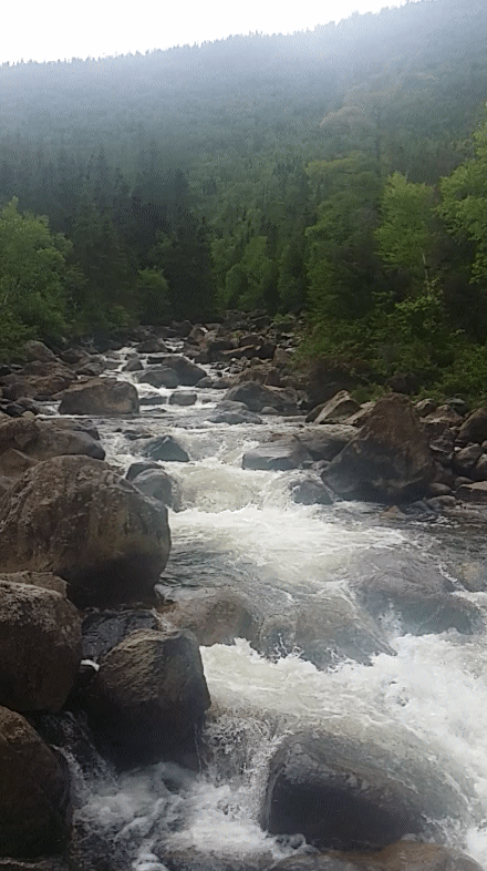
| The entrance to the Mont-Albert trail |
 |
| The river from the entrance bridge |
The first part of the trail was steep up sometimes the trail was nice sometimes it was rocky.
After about 1.5 km hikes, I could see the Auberge Le Gite du Mont-Albert hotel at the La Saillie observation deck.
From this point, the trails got harder.
 |
| 3km left out of 5.4 km to the top |
 |
| Small waterfall on the way up |
 |
| 1km left out of 5.4km to the top |
 |
| Rest point at 5km. There is a restroom here. |
 |
| 0.4km out of 5.4km to the top |
 |
| Steps to the top |
 |
| View from the top |
 |
| View from the top |
 |
| View from the top |
 |
| View from the top and a restroom |
Once arrived at the top, you can either chose to hike down from where I hike up or continue the loop as part of the Le Tour-du-Mont-Albert. I had a lunch at Les Rabougris, a small shack at the top of Mont Albert before continue the loop. Inside the shack, there is a book that you can sign showed that you reach the top of Mt. Albert. After lunch, I continued the hike thru the tableland, Le Versant about 1.1 km. In this tableland, lots of people can see caribou so keep an eye for them.
 |
| The Tableland, Le Versant trail from top of Mt. Albert |
The First part of Le Versant Trail
 |
| The Second Part of LeVersant Trail |
 |
| There are five caribous far away from the Le Versant Trail. In the middle of the pictures. You see it better there than from the picture |
 |
| Amazing view from the tableland |
 |
| Snow left on the mountain |
 |
| Hike down the tableland next to three levels of waterfall |
 |
| First part of the three levels of waterfall |
 |
| Second part of the three levels of waterfall |
 |
| The three levels of waterfall |
From this point, the hike was getting harder due to rocky trails next to a river and up and down another mountain. The next rest area located at La Serpentine about 3.2km away.
The first part of 3.2km trail to La Serpentine shack was rocky like the picture above. The next part was getting worse because the rocks were bigger and bigger. The worse part was to hike up this rocky trail
I wished the trail was getting better but the next part was the trail with hardened roots mix with the rocky trails. Since the day before was raining, some of the trail was muddy. At the end of my hike, my shoes were very dirty and covered with mud.
After 3.2km, I finally reached the La Serpentine and rest for 30 minutes before I continued. There was 6.1km left. After eating and resting, I continued the hike. About 0.5km, I reached Lac du Diable with an amazing view.
The next point was Chute du Diable. The trail was mostly hiking down. This fall is the highest waterfall in this trail loop.
 |
| Water flow from Chute du Diable |
From this point, there was 4.5km left. The trail was getting easier from this point. The last attraction in this trail was chute st-Anne.
By the time I was almost reach the end of the trail, I was so tired and did not feel like to take any pictures anymore. I was so excited that I finished the trail in total of 8 hours. The trail was amazing with lots of attraction to see and capture. There were lots of stuffs that I did not capture in my pictures. I would recommend people to try to hike this trail. It was long and hard but worth the hike. I rate this trail 5/5. Thanks for the information on this site. He had lots of pictures about the trail and more detail. Please check his website.


No comments:
Post a Comment