Fundy National Park is located next to the city of Alma, New Brunswick and on Bay of Fundy. Bay of Fundy is popular due to its world's highest tides up to 48 to 54 feet. To enjoy the tides, I would recommend to go to Hopewell Cape located at The Rocks Provincial Park, 35 minutes drive from Alma and enjoy the kayaking experience.
There are 25 hiking trails in this park from the easiest to most difficult one. For my visit, I skipped the trail with ocean views since the views is almost the same as the Fundy trail and Hopewell Cape had a better view that this park. The trails that is recommended is Dickson Falls Trail, Third Vault Falls Trail, and Moosehorn Trail.
There are couple campgrounds in the area: Headquarters, Chignecto, and Wolfe Point. All of the campgrounds are clean that offer clean toilet and showers, drinking water, and kitchen. For a family, you should try yurts or Otentik, it would be a nice experience to stay here.
 |
| Yurts (credit @ cbc.ca) |
 |
| Otentik (credit @ thechronicleherald.ca) |
On my visit, I reserved at Wolfe Point campground. This campground do not offer any electricity, water connection, or waste. To get here, a car has to pass a coverbridge that is not accessible with RV car. There is a fee to stay at this campground of $25.50 (for tents) plus $11 reservation fee. Also, there is a required entrance permit fee to the park for $7.80. Check all the pricing and information here. I reserved spot number 6.
I stayed here for one night. I got here around 7 PM from Fundy trail, set up the tent, cooked, took a shower, and slept. The next day, I plan to hike Moosehorn trail that connect to Laverty Falls trail.
 |
| Coverbridge toward Wolfe Point campground |
 |
| The views next to the coverbridge campground |
From Wolfe point campground, I drove to Laverty Rd to hike Moosehorn trail. When I got there, I saw to entrance: Laverty Falls trail and Moosehorn trail. I went thru the Laverty Falls trail which was a wrong decision. From the Moosehorn trail entrance, most of the trail is descending and some of them are steep. Since I went in from the Laverty Falls trail, I had to hike up which is harder that hike down. TIPS: ENTER FROM MOOSEHORN TRAIL.
The Laverty Falls was a medium difficulty hike but for me, I would rate it as easy.
 |
| Top of the Laverty Falls |
 |
| Top of the Laverty Falls |
 |
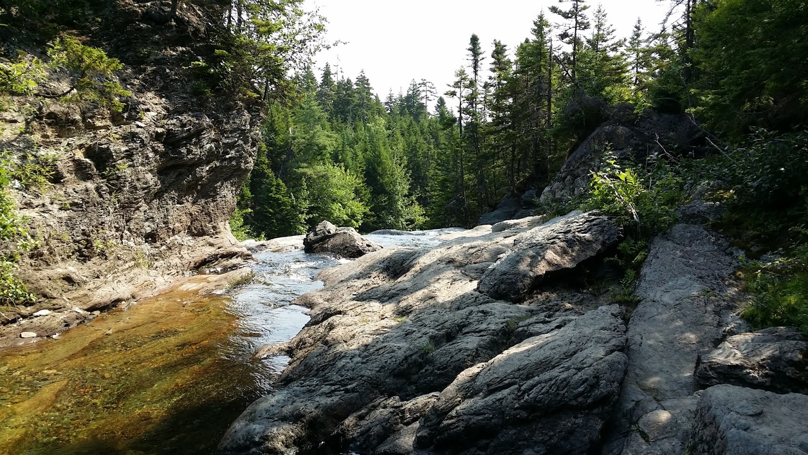
| The drop point towards Laverty Falls |
From Laverty Falls, I continued my hike towards Moosehorn Falls. The hike was not hard at all from Laverty Falls to Moosehorn Falls. There were couples river rocks that I had to cross to get back to the parking area.I would rate is as moderate due to the river rocks crossing and hike up.
It took me a total of 3 hours to hike the Moosehorn trail including an hour took pictures time. After the Moosehorn trail, there were two places that I visited. The top of Fundy National Park where you could look up at the ocean and the Wolfe point lake where people fish there.
 |
| The views to the ocean. Foggy day |
 |
| Wolfe Point lake |


No comments:
Post a Comment